📍 Tekirdağ, Türkiye Tekirdağ, Turkey

Prof. Dr.
Selçuk ALBUT

Akademisyen · CBS & Uzaktan Algılama Uzmanı · iOS Geliştirici · Spor Tutkunu Academic · GIS & Remote Sensing Expert · iOS Developer · Sports Enthusiast

Tekirdağ Namık Kemal Üniversitesi'nde CBS, Uzaktan Algılama ve Sulama Sistemleri üzerine araştırma ve öğretim yürütüyorum; 6 AB projesinde görev aldım. Swift ve Xcode ile Apple ekosistemi için uygulamalar geliştiriyor, uzmanlığımı ve spor tutkumu küresel ölçekte faydalı araçlara dönüştürmeye çalışıyorum. I conduct research and teaching in GIS, Remote Sensing and Irrigation Systems at Tekirdağ Namık Kemal University, and have taken part in 6 EU-funded projects. I build apps for the Apple ecosystem with Swift and Xcode, turning my expertise and passion for sports into tools with global reach.
🗺️ GIS / CBS 🛰️ Uzaktan Algılama 💧 Sulama ⚡ Swift / Xcode 🍎 iOS · iPadOS · watchOS
Selçuk Albut
21 Proje Projects
100+ Bilimsel Yayın Publications
5 Yayınlanan Kitap Published Books
8 Uygulama (4 iOS + 3 Web + 1 QGIS) Apps (4 iOS + 3 Web + 1 QGIS)

Lisans eğitimimi 1984'te Ankara Üniversitesi Ziraat Fakültesi Tarımsal Yapılar ve Sulama Bölümü'nde tamamladım. Yüksek lisansımı Trakya Üniversitesi'nde Kültürteknik alanında (1987), doktoramı ise yeniden Ankara Üniversitesi'nde Tarımsal Yapılar ve Sulama alanında (1992) tamamladım. Akademik kariyerime 1985'te Trakya Üniversitesi'nde araştırma görevlisi olarak başladım; sırasıyla yardımcı doçent (1992), doçent (2001) ve profesör (2009) unvanlarını aldım. 2006'dan bu yana Tekirdağ Namık Kemal Üniversitesi Ziraat Fakültesi Biyosistem Mühendisliği Bölümü'nde görev yapıyorum.

I completed my bachelor's degree in 1984 at Ankara University, Faculty of Agriculture, Department of Agricultural Structures and Irrigation. I earned my master's degree in Land and Water Resources Engineering at Trakya University (1987), and my PhD, again in Agricultural Structures and Irrigation, back at Ankara University (1992). I began my academic career in 1985 as a research assistant at Trakya University, and went on to become assistant professor (1992), associate professor (2001), and professor (2009). Since 2006 I have been with the Department of Biosystems Engineering, Faculty of Agriculture, Tekirdağ Namık Kemal University.

Akademik kariyerim boyunca Dekan Yardımcılığı, Bölüm Başkan Yardımcılığı, Beden Eğitimi ve Spor Yüksekokulu Kurucu Müdürlüğü, Meslek Yüksekokulu Müdürlüğü ve Rektör Danışmanlığı gibi idari görevler de üstlendim. Bugüne kadar 14 yüksek lisans ve 2 doktora tezi yönettim; CBS, Uzaktan Algılama ve Sulama Sistemleri alanlarında araştırma ve öğretim yürüttüm, toplam bütçesi 4,5 milyon Euro'yu aşan 6 Avrupa Birliği projesinde görev aldım — hâlihazırda proje koordinatörü olduğum GwB (Küresel Su Dengesi) projesi de bunlardan biri.

Throughout my career I have also taken on administrative roles, including Vice Dean, Deputy Department Head, Founding Director of the School of Physical Education and Sports, Director of a vocational school, and Rector's Advisor. I have supervised 14 master's and 2 doctoral theses to date, and conducted research and teaching in GIS, Remote Sensing and Irrigation Systems, taking part in 6 EU-funded projects with a total budget exceeding €4.5 million — including GwB (Global Water Balance), where I currently serve as project coordinator.

Swift ve Xcode kullanarak Apple ekosistemi için uygulamalar geliştiriyorum. Amacım; uzmanlık alanlarımı ve spor tutkumu küresel ölçekte faydalı uygulamalara dönüştürmek.

I develop apps for the Apple ecosystem using Swift and Xcode. My goal is to turn my areas of expertise and my passion for sports into globally useful applications.

Evli ve bir çocuk babasıyım.

I am married with one child.

🎓

Akademisyen

Academic

CBS ve Uzaktan Algılama alanında yıllarca araştırma, ders ve proje yürüttüm.

Years of research, teaching and projects in GIS and Remote Sensing.

📱

iOS Geliştirici

iOS Developer

Swift ile iPhone, iPad ve Apple Watch için global uygulamalar geliştiriyorum.

Building global apps for iPhone, iPad and Apple Watch with Swift.

Spor Tutkunu

Sports Enthusiast

Spor turnuvalarını takip etmek bir tutkum — bu tutkuyu uygulamaya döküyorum.

Following sports tournaments is my passion — turning it into apps.

Uzmanlık Alanları
Areas of Expertise
🗺️

CBS / GIS

Mekansal analiz ve haritalama

Spatial analysis & mapping

🛰️

Uzaktan Algılama

Remote Sensing

Uydu görüntüsü ile arazi analizi

Land analysis via satellite imagery

💧

Sulama

Irrigation

Sulama sistemleri ve su yönetimi

Irrigation systems & water management

🍎

iOS Geliştirme

iOS Development

Swift ile Apple ekosistemi

Apple ecosystem with Swift

🌾

Biyosistem Müh.

Biosystems Eng.

Tarımsal sistemlerin analizi

Agricultural systems analysis

🏆

Spor Uygulamaları

Sports Apps

Turnuva ve lig takip araçları

Tournament & league tracking

Kitaplar
Books
Hidroloji - Uygulamalı Havza Hidrolojisi

HİDROLOJİ — Uygulamalı Havza Hidrolojisi

HYDROLOGY — Applied Watershed Hydrology

İstanbulluoğlu A., Albut S., Şener M.
Nobel Akademik Yayıncılık
2026
QGIS ile CBS Temel Uygulamaları

QGIS ile Coğrafi Bilgi Sistemi Temel Uygulamaları

Basic GIS Applications with QGIS

Albut S., Şener M.
Platanus Publishing
2023
🛰️
ILMM-BSE
Ergene River Basin

Karadeniz Haliçlerinin Entegre Arazi Kullanımı Yönetim Modellemesi

Integrated Land Use Management Modeling of Black Sea Estuaries

Konukcu F., Albut S. (Eds.)
NKÜ · ISBN: 978-605-4265-43-5
2016
📐
Ölçme Bilgisi — I (4. Baskı)

Ölçme Bilgisi — I (4. Baskı)

Measurement Science — I (4th Ed.)

Albut S.
Ders Kitabı
Textbook
2006
💻
Bilgisayar Temel Bilgileri İşletim Sistemi

Bilgisayar Temel Bilgileri — İşletim Sistemi

Computer Fundamentals — Operating System

Albut S.
Ders Kitabı
Textbook
1993
Kitap Bölümleri
Book Chapters
Albut Selçuk. "Geospatial Artificial Intelligence (GeoAI): A Literature Review" — In: International Compilation of Research and Studies in the Field of Agriculture, Forestry and Aquaculture Sciences (Ed. Koray Özrenk, Ali Bolat), pp. 91-124. Serüven Publishing, 2025 PDF
Konukcu Fatih, Albut Selçuk, Kocaman İsrafil, Erdem Tolga. "İklime Duyarlı Tarım (İDT) Konsepti" — In: İklime Duyarlı Bitkisel Üretim (Ed. Fatih Konukcu, Selçuk Albut, İsrafil Kocaman, Tolga Erdem), pp. 1-16. Nobel Bilimsel Eserler, 2025 PDF
Albut Selçuk. "Pansharpening Techniques in Remote Sensing: A Comprehensive Review of Methods, Applications and Advances" — In: New Concepts and Advanced Studies in Agriculture, Forest and Water Issues (Ed. Nigar Yarpuz Bozdoğan), pp. 42-54. All Sciences Academy, 2025 PDF
Albut Selçuk, Şener Mehmet. "Methodology for Calculating the Normalized Difference Vegetation Index (NDVI) Utilizing Landsat Data in Remote Sensing" — In: New Trends and Frontiers in Engineering (Ed. Umut Özkaya), pp. 434-449. All Sciences Academy, 2024 PDF
Şener Mehmet, Albut Selçuk. "The Potential Use of Remote Sensing Technologies and Unmanned Aerial Vehicles (UAVs) in Agricultural Fields" — In: Agriculture, Forest and Aquatic Sciences in Theory and Practice (Ed. Vedat Çavuş, Senem Güneş Şen), pp. 170-189. Duvar Yayınları, 2024 PDF
Albut Selçuk. "Land Surface Temperature (LST) Calculation Processes with Landsat 8" — In: Pioneer and Innovative Studies in Engineering (Ed. Umut Özkaya), pp. 133-148. All Science Academy, 2024 PDF
Albut Selçuk. "Land Use Land Change Utilizing the QGIS MOLUSCE Plugin" — In: Mimarlıkta İleri Araştırmalar (Ed. Saadet Gündoğdu), pp. 170-187. Yaz Yayınları, 2024 PDF
Albut Selçuk. "QGIS: Open Source GIS Software and Plugins" — In: Innovative Research in Engineering (Ed. Berkan Balpetek), pp. 338-357. Duvar Publishing, 2023 PDF
Seçilmiş Bilimsel Makaleler
Selected Scientific Articles
Albut Selçuk. "Google Earth Engine and QGIS Integration: A Comprehensive Assessment of Cloud-Based and Desktop GIS System Integration" Journal of Scientific and Engineering Research, vol. 12, pp. 100-106, 2025 PDF
Albut Selçuk, Türkoğlu Tülin Tuanna. "Determination of Land Surface Temperature (LST) with Landsat 8: Application of Tekirdağ-Şarköy Region" Journal of Scientific and Engineering Research, vol. 12, pp. 15-24, 2025 PDF
Albut Selçuk. "Using Open Source GIS Based RUSLE Model in Erosion Risk Assessment" Journal of Multidisciplinary Engineering Science and Technology, vol. 7, pp. 13183-13189, 2020 PDF
Albut Selçuk. "Estimation of Slope Length (L) and Slope Steepness Factor (S) of RUSLE Equation by QGIS" International Journal of Research in Engineering and Science, vol. 8, pp. 43-48, 2020 PDF
Albut Selçuk. "Estimating of Soil Erosion Sensitivity Factor (K) with Open Sources Quantum GIS (QGIS) Software" Journal of Scientific and Engineering Research, vol. 7, pp. 90-95, 2020 PDF
Albut Selçuk. "Estimating the Soil Erosion Crop Factor (C) with Open Sources Geographical Information System (GIS) Software" European Journal of Advances in Engineering and Technology, vol. 7, pp. 4-10, 2020 PDF
Camuroğlu Ayhan, Albut Selçuk. "Modeling of Soil Erosion from Rains and Wind Using Remote Sensing and Geographic Information Systems" International Journal of Innovation Engineering and Science Research, vol. 4, pp. 26-37, 2020 PDF
Albut Selçuk. "Determination of R Factor in Revised Universal Soil Loss Equation (RUSLE) with Open Sources Geographical Information System (GIS) Software" Journal of Multidisciplinary Engineering Science and Technology (JMEST), vol. 7, pp. 12507-12510, 2020 PDF
Akkaya Nurseda, Albut Selçuk. "Determination of Suitable Areas in the Use of Renewable Energy Resources by Geographical Information System (GIS): The Case of Tekirdağ Province" Journal of Scientific and Engineering Research, vol. 6, pp. 130-136, 2019 PDF
Danışman Abdülkadir, Albut Selçuk. "A Database for Orchards with Free GIS Software: Tekirdağ-Işıklar Region Example" Journal of Multidisciplinary Engineering Science and Technology, vol. 6, pp. 10990-10993, 2019 PDF
Albut Selçuk, Bağdatlı Muhammed Cüneyt, Dumanlı Ömer. "Remote Sensing Determination of Variation in Adjacent Agricultural Fields in the Ergene River" Journal of Scientific and Engineering Research, vol. 5, pp. 113-122, 2018 PDF
Bostancı Abdulhakim, Albut Selçuk, Şener Mehmet. "Watershed Database Management with ArcHydro Model Builder Processing: Case Study of Tekirdağ Süleymanpaşa District" Journal of Scientific and Engineering Research, vol. 4, pp. 52-59, 2017 PDF
Konukcu Fatih, Albut Selçuk, Altürk Bahadır. "Land Use/Land Cover Change Modelling of Ergene River Basin in Western Turkey Using CORINE Land Use/Land Cover Data" Agronomy Research, vol. 15, pp. 435-443, 2017 PDF
Kocaman İsrafil, Konukcu Fatih, Albut Selçuk, İstanbulluoğlu Ahmet. "Effect of Irrigation with Maritza and Ergene Rivers Water on Soil Contamination and Heavy Metal Accumulation in Rice Crop" Bulgarian Journal of Agricultural Science, vol. 21, pp. 71-77, 2015 PDF
İstanbulluoğlu Ahmet, Konukcu Fatih, Kocaman İsrafil, Albut Selçuk. "MRRSSW Model of Rainfall Runoff in Small Sub Watershed" Journal of Environmental Protection and Ecology, vol. 14, pp. 1107-1114, 2013 PDF
Şener Mehmet, Albut Selçuk. "Irrigation Performance Assessment in Turkey Thrace Region Case Study" Bulgarian Journal of Agricultural Science, vol. 17, pp. 521-530, 2011 PDF
Şişman Can Burak, Albut Selçuk, Gezer Erhan, Göçmen Erhan. "Digitizing and Preparing Application and Setting Plan by Using GPS: A Case Study from Agricultural Faculty Area of Tekirdağ" African Journal of Agricultural Research, vol. 5, pp. 1772-1779, 2010 PDF
Albut Selçuk, İstanbulluoğlu Ahmet, Konukcu Fatih, Kocaman İsrafil. "Probable Water Crisis in Thrace and Istanbul in the Near Future and a Sustainable Strategy to Overcome It" Water International, vol. 32, pp. 590-603, 2007 PDF
Araştırma Alanları
Research Areas
🗺️

CBS / GIS

Tarımsal ve çevresel CBS uygulamaları, mekansal veri analizi

Agricultural and environmental GIS applications, spatial data analysis

🛰️

Uzaktan Algılama

Remote Sensing

Uydu görüntüleri ile tarımsal arazi izleme ve sınıflandırma

Agricultural land monitoring and classification using satellite imagery

💧

Sulama Sistemleri

Irrigation Systems

Sulama planlaması, su tasarrufu ve akıllı sulama yönetimi

Irrigation planning, water conservation and smart irrigation management

GwB proje posteri
2025–2028
BSB00734 · Interreg Next VI-B Karadeniz Havzası

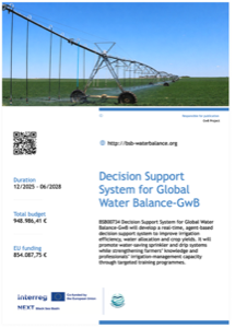
Küresel Su Dengesi için Karar Destek Sistemi (GwB)

Decision Support System for Global Water Balance (GwB)
Sulama verimliliği, su tahsisi ve ürün verimi üzerine yapay zeka destekli model
AI-supported model for irrigation efficiency, water allocation and crop yield
Bütçe
Budget
€948.986
OrtakCo-applicant
● Devam Ediyor● Ongoing
İklimTrak proje posteri
2023–2026
CCAGP088 · AB İklim Değişikliğine Uyum Hibe Programı

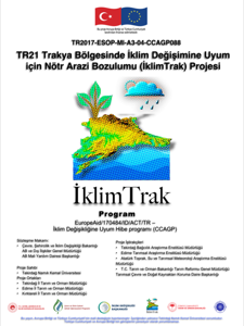
TR21 Trakya Bölgesinde İklim Değişimine Adaptasyon için Nötr Arazi Bozunumu — İklimTrak

Land Degradation Neutrality for Climate Change Adaptation in TR21 Trakya Region — İklimTrak
Trakya'da tarımsal arazi bozunumunun önlenmesi ve iklim adaptasyonu
Prevention of agricultural land degradation and climate adaptation in Thrace
Bütçe
Budget
€346.573
YürütücüLead Partner
● Devam Ediyor● Ongoing
AGREEN proje posteri
2017–2021
BSB1135 · AB Karadeniz Havzası Sınır Ötesi İşbirliği

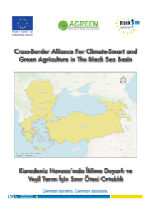
Karadeniz Havzasında İklim Akıllı ve Yeşil Tarım için Sınır Ötesi İttifak (AGREEN)

Cross-Border Alliance for Climate-Smart and Green Agriculture in the Black Sea Basin (AGREEN)
Karadeniz havzasında sürdürülebilir tarımsal uygulamalar
Sustainable agricultural practices in the Black Sea basin
Bütçe
Budget
€799.279
OrtakCo-applicant
TamamlandıCompleted
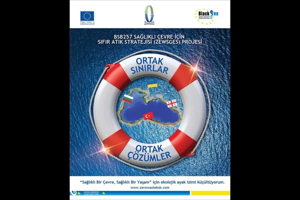
Sıfır Atık Stratejisi proje posteri
2017–2021
BSB217 · AB Karadeniz Havzası Sınır Ötesi İşbirliği

İyi Çevre Durumu için Sıfır Atık Stratejisi

Zero Waste Strategy for Good Environmental Status
Karadeniz havzasında çevre yönetimi ve sıfır atık stratejileri
Environmental management and zero waste strategies in the Black Sea basin
Bütçe
Budget
€872.118
YürütücüLead Partner
TamamlandıCompleted
CCGS042 proje posteri
2013–2015
CCGS042 · AB İklim Değişikliği Kapasite Geliştirme Hibe Programı

Trakya Bölgesinde İklim Değişikliğinin Azaltılması ve Adaptasyonu için Kapasite Geliştirme

Capacity Building for Climate Change Mitigation and Adaptation in Trakya Region
Kurumsal ve teknik kapasite güçlendirme
Institutional and technical capacity building
Bütçe
Budget
€193.884
OrtakCo-applicant
TamamlandıCompleted
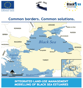
ILMM-BSE proje posteri
2007–2017
ILMM-BSE · AB Karadeniz Havzası Ortak Operasyonel Programı

Karadeniz Haliçlerinin Entegre Arazi Kullanımı Yönetim Modellemesi (ILMM-BSE)

Integrated Land-use Management Modelling of Black Sea Estuaries (ILMM-BSE)

Ergene Havzası'nda arazi kullanımı ve su kalitesi entegre yönetimi
Integrated land use and water quality management in the Ergene Basin
Bütçe
Budget
€1.344.782
OrtakCo-applicant
TamamlandıCompleted
6 AB Projesi · Toplam Fon
6 EU Projects · Total Funding
€ 4.505.622
Web Uygulamaları
Web Apps
💧

Sulama Programlama / ETo Hesaplayıcı

Irrigation Scheduling / ETo Calculator

NASA POWER uydu/reanaliz iklim verisiyle FAO-56 Penman-Monteith yöntemine göre referans buharlaşma-terleme (ETo) ve bitki su tüketimini (ETc) hesaplayın; net sulama suyu ihtiyacını görün.

Calculate reference evapotranspiration (ETo) and crop water use (ETc) with the FAO-56 Penman-Monteith method, fed automatically by NASA POWER satellite/reanalysis climate data — get the net irrigation water requirement.

🧭

Koordinat ve Datum Dönüştürme

Coordinate & Datum Converter

Ondalık Derece, DMS, DDM, UTM ve MGRS formatları; ED50, WGS84 ve ITRF96/TUREF datumları arasında dönüştürün. Sonucu tek tıkla kopyalayıp CBS yazılımınıza aktarın.

Convert between Decimal Degree, DMS, DDM, UTM and MGRS formats, and between ED50, WGS84 and ITRF96/TUREF datums. Copy the result straight into your GIS software.

🧮

Akademik Teşvik Hesaplama

Academic Incentive Calculator

Akademik Teşvik Ödeneği Yönetmeliği'ne göre puanınızı ve tahmini aylık ödeneğinizi hesaplayın — Proje, Yayın, Atıf, Tebliğ ve diğer faaliyet türlerini ekleyerek.

Calculate your academic incentive score and estimated monthly payment under Turkey's Academic Incentive Regulation — add your projects, publications, citations and more.

Mobil Uygulamalar
Mobile Apps
Sayaç ve Takvim

Sayaç ve Takvim — App Store'da

Sayaç ve Takvim — On the App Store

Hayatındaki önemli anları geri sayımla takip et: seyahatler, sınavlar, doğum günleri ve daha fazlası. Hedeflerini kategorilere ayır, her birine gün/saat/dakika olarak ne kadar kaldığını gör ve ilerlemeni tek bakışta takip et.

Count down to what matters — trips, exams, birthdays and more. Organize your goals into categories, see exactly how much time is left for each in days, hours and minutes, and track your progress at a glance.

Sayaç ve Takvim - Ana Sayfa Sayaç ve Takvim - Detay
iPhone App Store'da Yayında Live on the App Store
🍎 App Store'da Görüntüle 🍎 View on the App Store
QR code Telefonunuzla okutun Scan with your phone
Global Sports Tracker

Global Sports Tracker — App Store'da

Global Sports Tracker — On the App Store

Büyük turnuvaları tek yerden takip et: canlı skorlar, gruplar, eleme turları/bracket, puan durumu ve takım istatistikleri — güncel bir turnuva takip merkezi.

Track major tournaments in one place: live scores, groups, knockout brackets, standings and team statistics — a complete tournament tracking hub.

Global Sports Tracker - Ana Sayfa Global Sports Tracker - Puan Durumu
iPhone iPad App Store'da Yayında Live on the App Store
🍎 App Store'da Görüntüle 🍎 View on the App Store
QR code Telefonunuzla okutun Scan with your phone
Kalorimatik AI

Kalorimatik AI — App Store'da

Kalorimatik AI — On the App Store

Tabağınızın fotoğrafını çekin, yapay zeka saniyeler içinde kalori ve besin değerlerini (protein, karbonhidrat, yağ) tahmin etsin. Kayıt gerekmez, sonuçlar isterseniz Apple Sağlık'a otomatik kaydedilir. Artık İngilizce, Almanca, Fransızca, İtalyanca ve İspanyolca dillerinde de kullanılabilir.

Snap a photo of your plate and let AI estimate calories and macros (protein, carbs, fat) in seconds. No account needed — results can sync automatically with Apple Health. Now also available in English, German, French, Italian and Spanish.

Kalorimatik AI - Ana Sayfa Kalorimatik AI - Sonuç
iPhone App Store'da Yayında Live on the App Store
🍎 App Store'da Görüntüle 🍎 View on the App Store
QR code Telefonunuzla okutun Scan with your phone
GST Cycling

GST Cycling — App Store'da

GST Cycling — On the App Store

Bisiklet yarışlarını canlı takip edin. Tour de France ve La Vuelta gibi turlar için etap bilgisi, parkur profilleri, mesafe/tarih detayları ve hatırlatıcılarla dolu bir yarış takvimi.

Follow professional cycling races. Stage-by-stage info, race profiles, distance/date details and reminders for tours like the Tour de France and La Vuelta.

GST Cycling - Ana Sayfa GST Cycling - Yarış Önizleme
iPhone iPad App Store'da Yayında Live on the App Store
🍎 App Store'da Görüntüle 🍎 View on the App Store
QR code Telefonunuzla okutun Scan with your phone
QGIS Eklentileri
QGIS Plugins
Thiessen Sulama Ağırlıklandırma

Thiessen Sulama Ağırlıklandırma — plugins.qgis.org'da Deneysel

Thiessen Irrigation Weighting — Experimental on plugins.qgis.org

İstasyon noktalarından (yağış, su ihtiyacı, debi vb.) Thiessen/Voronoi poligonları üretip isteğe bağlı bir sulama alanı sınırına göre keser, her hücrenin gerçek (elipsoidal) alanına göre alan ağırlıklı ortalamayı hesaplar. QGIS Processing'in yerleşik Voronoi algoritmasını sarmalayan, arayüzlü ve açık kaynaklı bir Python eklentisi.

Generates Thiessen (Voronoi) polygons from station points (rainfall, irrigation water requirement, discharge, etc.), optionally clips them to an irrigation area boundary, and computes the area-weighted average based on each cell's true ellipsoidal area. An open-source Python plugin with a GUI, built on top of QGIS Processing's native Voronoi algorithm.

Thiessen Sulama Ağırlıklandırma - Eklenti Arayüzü Thiessen Sulama Ağırlıklandırma - Harita Sonucu
QGIS 3.16+ Deneysel Sürüm Experimental Release Açık Kaynak (GPLv2+) Open Source (GPLv2+)
📦 Tüm uygulamalar Apple App Store'da yayınlanacaktır. Güncel gelişmeler için GitHub sayfamı takip edin. 📦 All apps will be published on the Apple App Store. Follow my GitHub for updates.
2026 Temmuz–Aralık dönemi tutarı (9.500 gösterge × 1,575512 memur aylık katsayısı). Her dönem güncellendiğinde buradan değiştirin. July–December 2026 figure (9,500 indicator × 1.575512 civil servant coefficient). Update here whenever the period changes.
0.00 Toplam Teşvik Puanı (/100) Total Incentive Score (/100)
0 ₺ Tahmini Aylık Ödenek Estimated Monthly Payment
- Ödeme Eşiği (min. 30 puan) Payment Threshold (min. 30 pts)
ℹ️ Bu hesaplayıcı bilgilendirme amaçlıdır, resmi bir başvuru veya kurum kararı yerine geçmez. Nihai puan, ilgili birim/üniversite akademik teşvik komisyonunca belirlenir. ℹ️ This calculator is for informational purposes only and does not replace an official application or institutional decision. The final score is determined by your university's academic incentive committee.

1. Girdi

1. Input

2. Çıktı Datumu

2. Output Datum

ℹ️ ITRF96/TUREF, bu araçta WGS84 ile aynı kabul edilir (aradaki fark santimetre seviyesindedir). ED50 ↔ WGS84 dönüşümü, Türkiye için resmi EPSG:1784 parametreleriyle (~2 m doğruluk, orta/düşük hassasiyetli kullanım için) yapılır. Jeodezik/RTK hassasiyeti gereken resmi işler için Harita Genel Müdürlüğü'nün kendi dönüşüm uygulamasını kullanın. ℹ️ ITRF96/TUREF is treated as identical to WGS84 in this tool (the difference is centimeter-level). The ED50 ↔ WGS84 shift uses the official EPSG:1784 parameters for Turkey (~2 m accuracy, for medium/low-precision use). For survey-grade/RTK work, use the General Directorate of Mapping's own transformation service.

📖 Kullanım Kılavuzu 📖 User Guide

Bu araç, konu hakkında uzman olmasanız bile kullanılabilecek şekilde tasarlandı. Sulama planlaması yaparken bitkinin ne kadar su tükettiğini (ETc) ve mevcut yağışın bunu ne kadar karşıladığını görürsünüz; kalan fark net sulama suyu ihtiyacınızdır.

This tool is designed to be usable even if you're not an expert in the field. It shows how much water your crop consumes (ETc) and how much of that the recent rainfall already covers; the remaining gap is your net irrigation water requirement.

Adım Adım Kullanım

Step by Step

  1. Konum: Aşağıdaki haritada tarlanızın olduğu yere tıklayın (ya da işaretçiyi sürükleyin), veya "📍 Konumumu Kullan" butonuna basın. Enlem/boylamı GPS'ten biliyorsanız kutulara elle de yazabilirsiniz.
  2. Bitki: Yetiştirdiğiniz bitkiyi listeden seçin.
  3. Ekim/Dikim/Vejetasyon Başlangıcı: Tek yıllık bitkilerde ekim/dikim tarihini, çok yıllık bitkilerde (meyve ağacı, bağ, zeytin vb.) o yılki yaprak açımı/vejetasyon başlangıç tarihini girin — araç bu tarihten itibaren geçen güne göre bitkinin su ihtiyaç katsayısını (Kc) otomatik hesaplar.
  4. Hesaplama Aralığı: Hangi dönem için sulama suyu ihtiyacını görmek istediğinizi seçin (örn. son 10 gün). Varsayılan aralık zaten makul bir seçimdir.
  5. Hesapla butonuna basın ve aşağıdaki sonuç kartlarını ve günlük tabloyu inceleyin.
  1. Location: Click your field's location on the map below (or drag the marker), or press "📍 Use My Location". If you know the exact GPS coordinates, you can also type them into the boxes.
  2. Crop: Pick the crop you're growing from the list.
  3. Planting / Season-Start Date: For annual crops enter the planting date; for perennial crops (fruit trees, vineyard, olive, etc.) enter that year's leaf-out/growing-season start date — the tool uses the days elapsed since then to automatically compute the crop's water-use coefficient (Kc).
  4. Period: Choose the period you want the irrigation requirement for (e.g. the last 10 days). The default range is already a reasonable choice.
  5. Press Calculate and read the result cards and the daily table below.

Terimler

Glossary

  • ETo (Referans Buharlaşma-Terleme): İklim koşullarına göre, referans bir çim yüzeyinin bir günde ne kadar su buharlaştırıp terlediği (mm/gün). Sadece havaya bağlıdır, bitkiden bağımsızdır.
  • Kc (Bitki Katsayısı): Seçtiğiniz bitkinin, gelişim evresine göre ETo'ya kıyasla ne kadar su tükettiğini gösteren çarpan (genelde 0.3 – 1.2 arası).
  • ETc (Bitki Su Tüketimi): ETo × Kc — bitkinizin gerçek su tüketimi (mm).
  • mm (milimetre su): 1 mm yağış/sulama = her metrekareye 1 litre su demektir.
  • m³/da (metreküp / dekar): Çiftçilerin alışık olduğu birim. 1 mm = 1 m³/da (yani 1000 m²'lik bir tarlaya 1 mm su vermek 1 ton/m³ su gerektirir).
  • Etkin Yağış: Yağan yağmurun toprakta tutulup bitki tarafından kullanılabilen kısmı (tamamı değil — bir kısmı yüzeyden akar veya derine sızar).
  • Thiessen Poligonu (Voronoi Hücresi): Hidrolojide istasyon verilerini alansal ağırlıklandırmak için kullanılan klasik yöntem — her istasyona, ona en yakın olan tüm noktaları içeren bir bölge (poligon) atanır. Konumunuz hangi istasyonun poligonuna düşerse, hesaplamada o istasyonun verisi kullanılır; haritadaki ince çizgiler bu poligonları gösterir.
  • ETo (Reference Evapotranspiration): How much water a reference grass surface evaporates and transpires in a day, based purely on climate (mm/day). Independent of the crop.
  • Kc (Crop Coefficient): A multiplier showing how much your selected crop uses relative to ETo at its current growth stage (typically 0.3–1.2).
  • ETc (Crop Water Use): ETo × Kc — your crop's actual water consumption (mm).
  • mm (millimetres of water): 1 mm of rain/irrigation = 1 litre of water per square metre.
  • m³/da (cubic metres per decare): The unit farmers commonly use. 1 mm = 1 m³/da (applying 1 mm to a 1,000 m² field takes 1 m³ / 1 tonne of water).
  • Effective Rainfall: The portion of rainfall actually retained in the soil and usable by the crop (not all of it — some runs off or drains too deep).
  • Thiessen Polygon (Voronoi Cell): The classic hydrology method for areal-weighting station data — each station is assigned the region containing every point closer to it than to any other station. Whichever station's polygon your location falls in is the one used in the calculation; the thin lines on the map show these polygons.
Örnek: Kırşehir yakınında (39.93°K, 34.88°D), 1 Mayıs'ta ekilen mısır için 24 Temmuz – 3 Ağustos aralığını hesaplarsanız: Toplam ETo ≈ 45.8 mm, bitki bu dönemde 1.15 Kc katsayısıyla (ortasezon) ETc ≈ 52.7 mm su tüketir. Dönemde ~13 mm yağış düşmüş ve bunun etkin kısmı (~13 mm) düşülünce net sulama ihtiyacı ≈ 39.7 mm = dekar başına yaklaşık 40 m³ (40 ton) su demektir — yani bu 10 günlük dönemde tarlanızın her dekarına ~40 ton su vermeniz gerekir.
Example: Near Kırşehir (39.93°N, 34.88°E), for maize planted on May 1, calculating the July 24 – August 3 period gives: Total ETo ≈ 45.8 mm, and at its mid-season Kc of 1.15 the crop uses ETc ≈ 52.7 mm. About 13 mm of rain fell in that period, and once its effective portion (~13 mm) is subtracted, the net irrigation requirement ≈ 39.7 mm = roughly 40 m³ (40 tonnes) of water per decare — meaning you'd need to apply about 40 tonnes of water per decare of your field over this 10-day period.

1. Konum

1. Location

Haritaya tıklayarak veya işaretçiyi sürükleyerek konum seçebilirsiniz. Küçük noktalar 259 resmi meteoroloji istasyonunu gösterir — üzerine gelince adını, tıklayınca ayrıntılarını görebilirsiniz. İnce çizgiler istasyonların Thiessen poligonlarını (Voronoi hücrelerini), turuncu vurgulu alan ise konumunuzun düştüğü — dolayısıyla hesaplamada kullanılan — istasyonun etki alanını gösterir.

Click the map or drag the marker to pick a location. The small dots mark all 259 official meteorology stations — hover for the name, click for details. The thin lines are each station's Thiessen polygon (Voronoi cell); the orange-highlighted area is the zone your location falls in — and therefore the station used in the calculation.

2. Bitki ve Tarihler

2. Crop & Dates

Çok yıllık bitkilerde (meyve, bağ, zeytin vb.) yaprak açımı/vejetasyonun başladığı tarihi girin. For perennial crops (fruit trees, vineyard, olive, etc.) enter the leaf-out/growing-season start date.
ℹ️ Türkiye içinde en yakın resmi istasyon 80 km içindeyse, hesaplama varsayılan olarak TAGEM/DSİ'nin 2017 tarihli "Türkiye'de Sulanan Bitkilerin Bitki Su Tüketimleri" rehberindeki resmi istasyon verilerini (259 istasyon, 29 iklim bölgesi, uzun yıllar 10 günlük normalleri) kullanır — istenirse NASA POWER'a manuel geçilebilir. Türkiye dışında veya yakında istasyon yoksa NASA POWER uydu/reanaliz verisi ve FAO-56 genel Kc değerleri kullanılır; bu veri son birkaç gün için henüz yayınlanmamış olabilir. Resmi kılavuzda bazı bitkiler için (özellikle küçük istasyon sayılı bölgelerde) Kc verisi eksik olabilir ve o durumda listede görünmez. Yonca gibi sezon içinde birden fazla kez biçilen yem bitkileri NASA POWER motorunda kapsam dışıdır (resmi kılavuz motorunda biçim dönemleri ayrı ayrı listelenir). Resmi kılavuzda etkin yağış, düşen yağışın %80'i olarak kabul edilir (rehberin kendi formülü); NASA POWER modunda ise ampirik SCS formülü kullanılır. Bu araç bilgilendirme amaçlıdır; sulama zamanlaması kararını saha gözlemi ve/veya toprak nem sensörü ile doğrulayın. ℹ️ Inside Turkey, if the nearest official station is within 80 km, calculations default to station data from TAGEM/DSİ's 2017 "Water Consumption of Irrigated Crops in Turkey" guide (259 stations, 29 climate zones, long-term 10-day normals) — you can switch to NASA POWER manually if you prefer. Outside Turkey, or with no nearby station, NASA POWER satellite/reanalysis data and generic FAO-56 Kc values are used instead; that data may not be published yet for the last few days. A few crops (especially in small, single-station regions) are missing Kc data in the official guide and won't appear in that mode's crop list. Multi-cut forage crops like alfalfa are out of scope in the NASA POWER engine (the official-guide engine lists each cutting cycle separately). The official guide treats 80% of rainfall as effective (its own formula); the NASA POWER mode uses the empirical SCS formula instead. This tool is informational only — confirm irrigation timing with field observation and/or a soil-moisture sensor.

Mesaj Gönderin

Send a Message

✅ Mesajınız gönderildi, teşekkürler! En kısa sürede dönüş yapacağım. ✅ Your message has been sent, thank you! I'll get back to you soon.